EPA Monitoring
Environment Protection License Monitoring Data
| Facility | Latest Results | Date published | Location | Licence | Anniversary Date |
|---|---|---|---|---|---|
| Oakey Park Water Treatment Plant | OWTP Results | 18/04/2024 | Bells Road, Lithgow | 2396 | 01 July |
| Lithgow Sewage Treatment Plant | LSTP Results | 18/04/2024 | Geordie Street, Lithgow | 236 | 01 July |
| Portland Sewage Treatment Plant | PSTP Results | 18/04/2024 | Albion Road, Portland | 597 | 01 July |
| Wallerawang Sewage Treatment Plant | WSTP Results | 18/04/2024 | Brays Lane, Wallerawang | 598 | 01 July |
| Lithgow Solid Waste Facility | LSWF Results | 27/02/2024 | Geordie Street, Lithgow | 6004 | 24 September |
| SW1 Discharge | 01/02/2024 | Geordie Street, Lithgow | 6004 | 24 September | |
| Gas monitoring | 26/06/2023 | Geordie Street, Lithgow | 6004 | 24 September | |
| Portland Garbage Depot | PSWF Results | 07/03/2024 | Cullen Bullen Road | 10936 | 17 August |
| SW1 Discharge | 11/03/2024 | Cullen Bullen Road | 10936 |
For more information on the individual sites including pollution incident response management plans and monitoring sites click on the links below
Oakey Park Water Treatment Plant
Lithgow Sewage Treatment Plant
Portland Sewage Treatment Plant
Wallerawang Sewage Treatment Plant
Oakey Park Water Treatment Plant
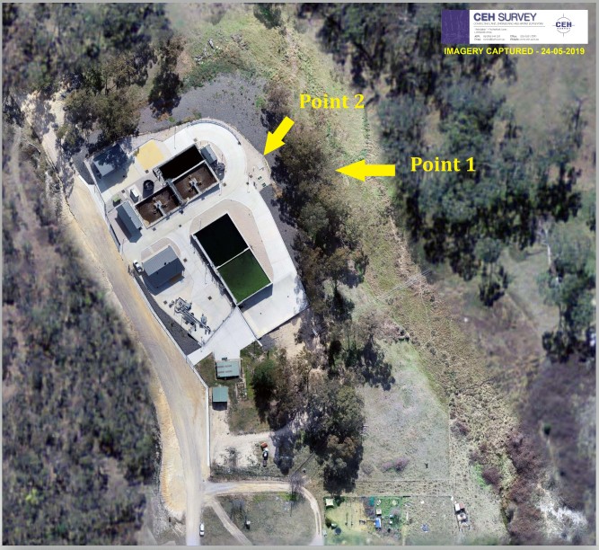
Map of Monitoring Points
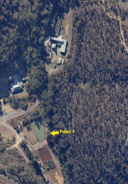
Sample Point 1
Outlet to Farmers Creek from the combined discharge pit for the two sludge lagoons (the combined discharge pit is located within the north-western lagoon, known as lagoon 1
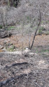
Sample Point 1
Secondary image of Sample point 1

Lithgow Sewage Treatment Plant
Map of Monitoring Points
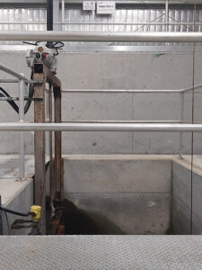
Sample Point 1
Final effluent pit prior to the discharge channel to Farmers Creek (located in UV disinfection shed)
Sample Point 3
100 meters upstream of the confluence between the discharge channel and Farmers Creek

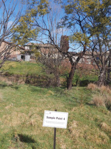
Sample Point 4
200 metres downstream of the confluence between the discharge from Point 1 and Farmers Creek
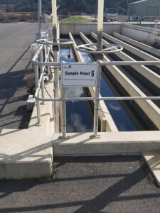
Sample Point 5
Chlorine contact tank weir
Portland Sewage Treatment Plant
Map of Monitoring Points
Sample Point 1
Outlet from discharge drain to Limestone Creek.
Sample Point 2
Final flowmeter (located after UV disinfection and before discharge drain to Limestone Creek.
Wallerawang Sewage Treatment Plant
Map of Monitoring Points
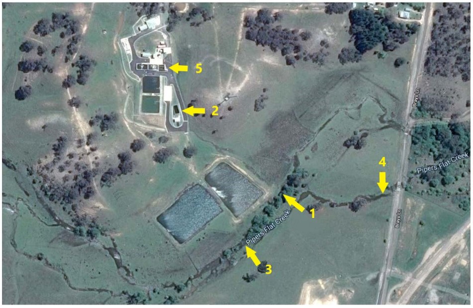
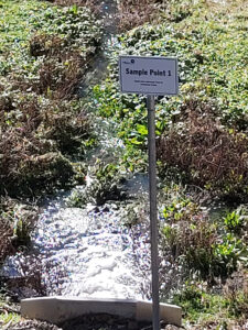
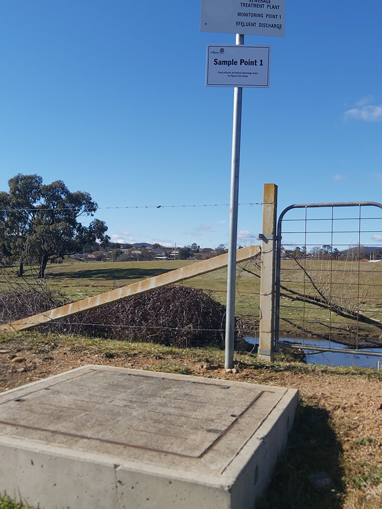
Sample Point 1
Final effluent pit before discharge drain to Pipers Flat Creek
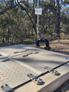
Sample Point 2
Final flowmeter (located after UV disinfection and before final effluent pit)

Sample Point 3
100 meters upstream of the confluence between the discharge drain and Pipers Flat Creek

Sample Point 4
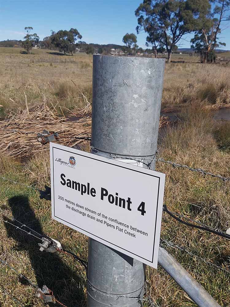
200 meters downstream of the confluence between the discharge drain and Pipers Flat Creek
Sample Point 5
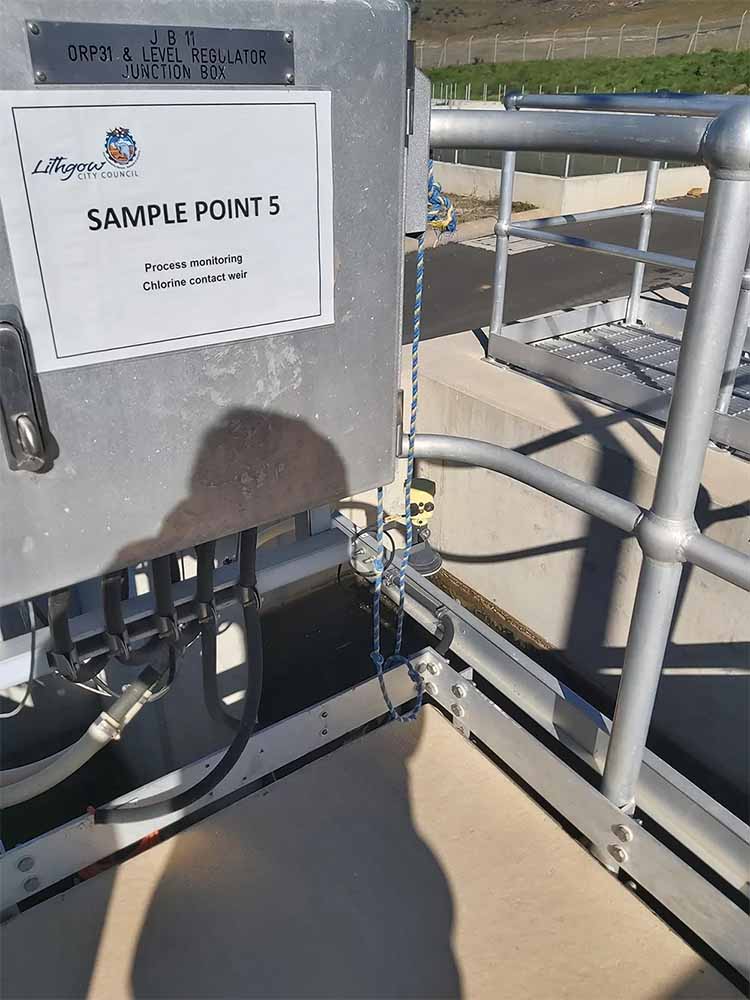
Chlorine contact weir
Lithgow Solid Waste Facility
Map of Monitoring Points for Lithgow Solid Waste Facility
Lithgow SW1 Monitoring 10 January 2024
Lithgow SW1 Monitoring Data 28 November 2022Lithgow SWF Monitoring Data 9 June 2023
Lithgow SW1 October 2022 Monitoring Report
Lithgow SWF Monitoring Data 3 June 2021
Lithgow SWF Monitoring Data 21 January 2021Lithgow SW1 April 2020 Monitoring Report
Lithgow December 2019 Monitoring Report
Lithgow July 2019 Additional Monitoring Report
Lithgow May 2019 Monitoring Report
Lithgow SW1 December 2018 Monitoring Report
Lithgow December 2018 Monitoring Report
Lithgow May 2018 Monitoring Report
Lithgow November 2017 Monitoring Report
Lithgow 2016-2017 Monitoring Report
Lithgow 2015-2016 Monitoring Report
Lithgow 2014-2015 Monitoring Report
Lithgow 2013-2014 Monitoring Report
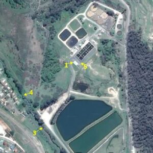
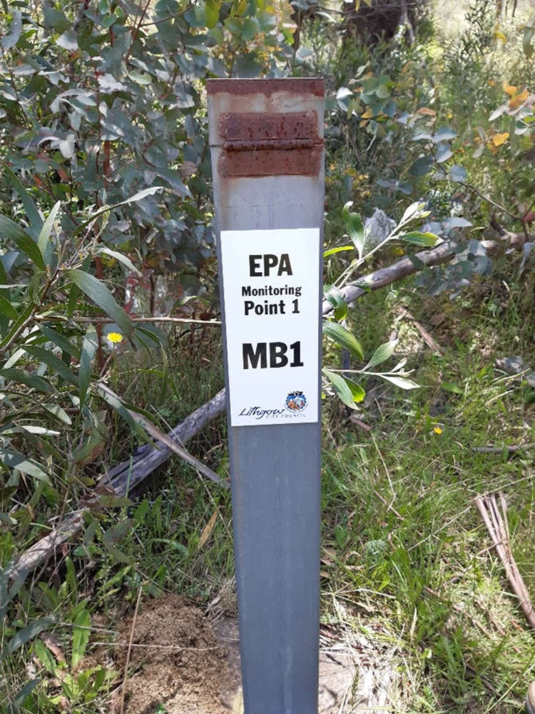
Sample Point 1
Groundwater MB1
Located on the upper rim of the north-western corner of the sandy borrow pit on the edge of bushland (north of the landfill area).
Sample Point 2
Groundwater MB5
Located on Sewage Treatment Plant grounds in the small car parking area immediately west of the office. Access is via the road leading to the office building.

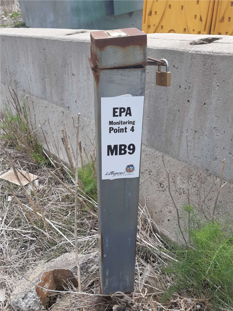
Sample Point 4
Groundwater MB9
Access is directly off the landfill road.
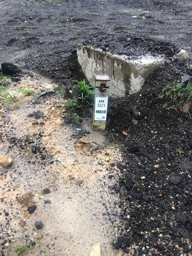
Sample Point 5
Groundwater MB10
Located upon approach to the Stormwater Dam (EPA Surface Water Sample point SW1) located near the operational stockpile area.
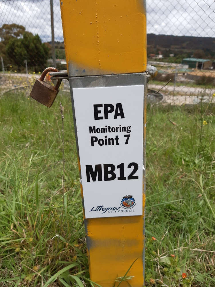
Sample Point 7
Groundwater MB12
Located between the Sewage Treatment Plant fence and the landfill access road. Access is via the landfill access road.
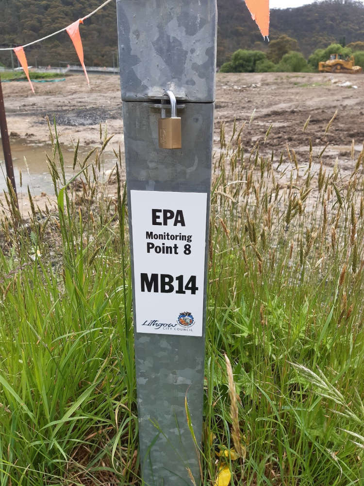
Sample Point 8
Groundwater MB14
Located behind the Resource Recovery Centre (RRC). Access is made by entering the RRC site and parking to the rear of the large re-use shed. The sample point is located in front of the stormwater dam.
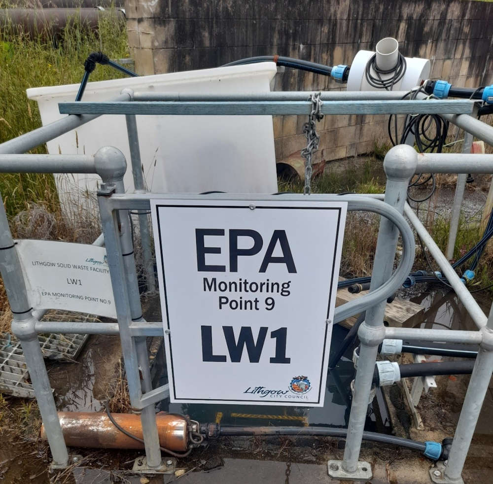
Sample Point 9
Leachate LW1
Located on Sewage Treatment Plant grounds at the base of the slope and edge of concrete paving directly west of the office. Access is via the walkway and stairs.
Portland Solid Waste Facility
Map of monitoring points for Portland Solid Waste Facility
Pollution Incident Response Management Plan For Portland Solid Waste Facility
Portland SW1 Discharge June 2022
Portland Monitoring Report 23 March 2023
Portland 2019-2020 Monitoring Report
Portland 2018-2019 Monitoring Report
Portland 2017-2018 Monitoring Report
Portland 2016-2017 Monitoring Report
Portland 2015-2016 Monitoring Report
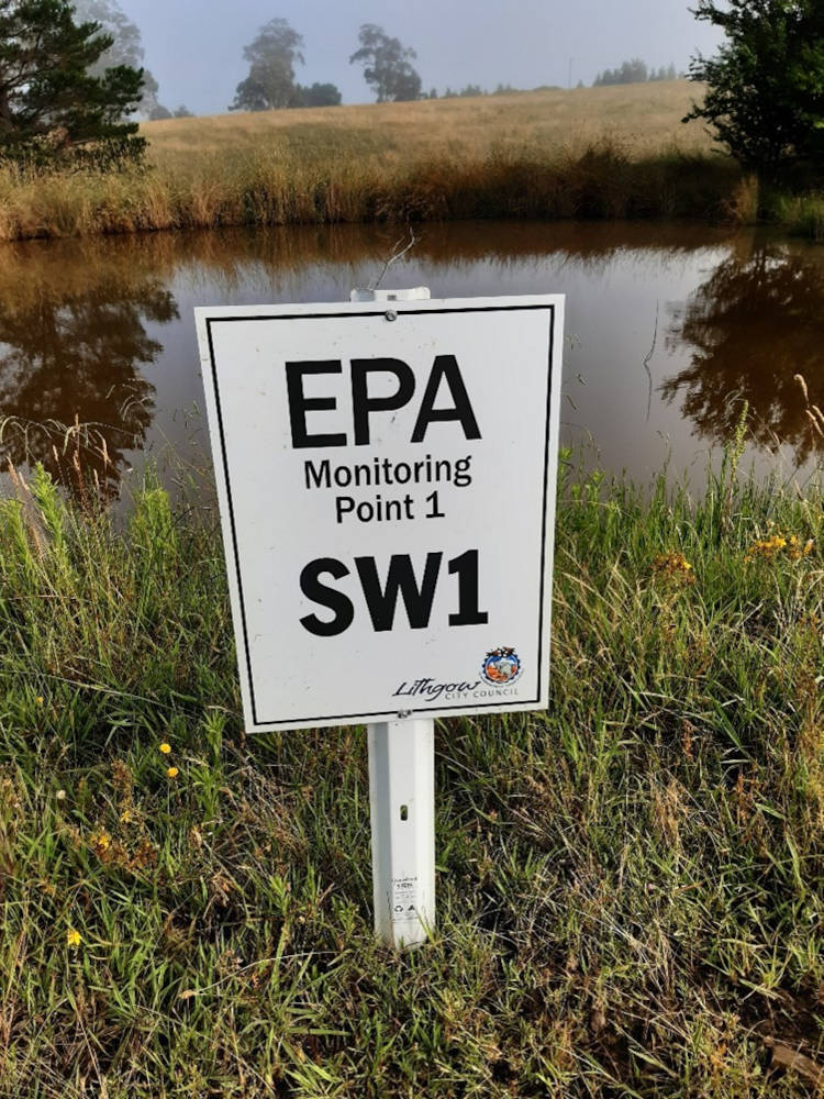
Sample Point 1
Surface Water SW1
Located towards the north-western boundary of the waste depot. SW1 is the most westerly holding pond out of a series of 3 small dams. Access is through a locked internal gate running north along the far western fence line.
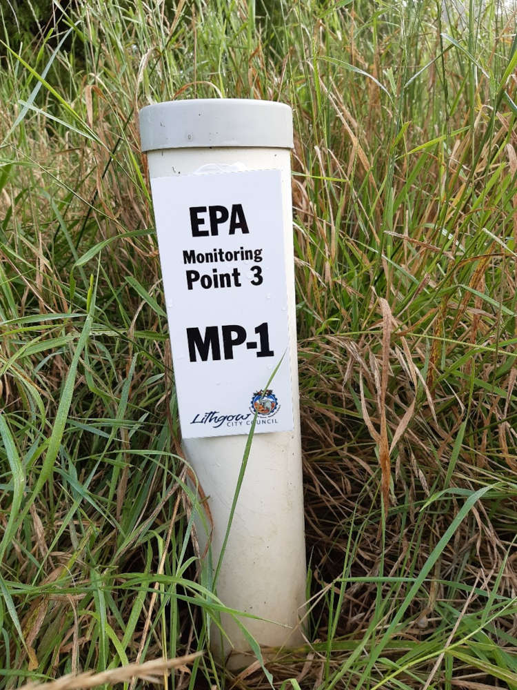
Sample Point 3
Groundwater MP-1
MP-1. Located immediately west of the sediment basin dam on the northern boundary of the waste depot. The peizometer is situated at the base of the dam bank. Access is through a locked internal gate running north along the far western fence line.
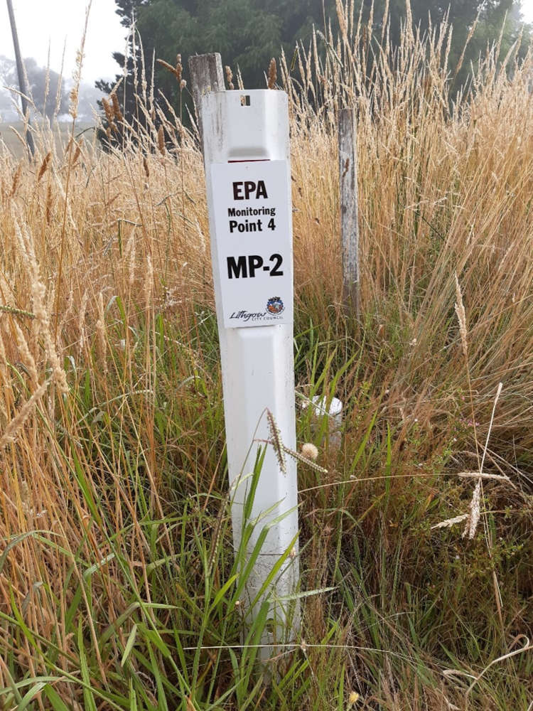
Sample Point 4
Groundwater MP-2
MP-2. Located on the slopes immediately south-east of the 3 small holding ponds situated towards the north-western corner of the site (including SW1). Access is through a locked internal gate running north along the far western fence line.
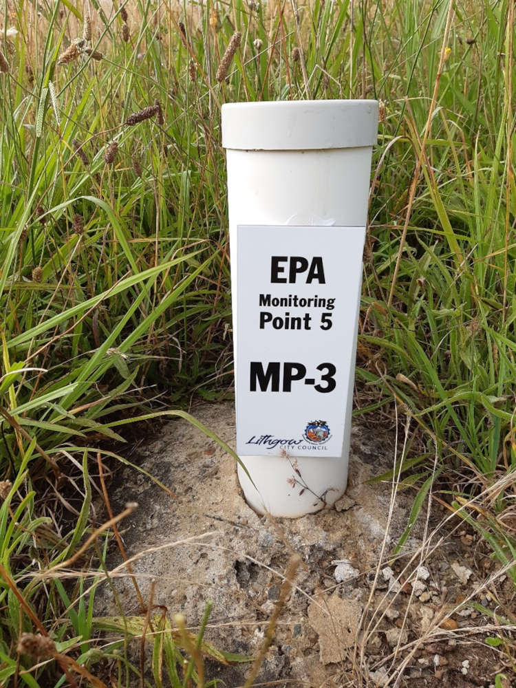
Sample Point 5
Groundwater MP-3
Located on the slopes immediately south of the 3 small holding ponds situated towards the north-western corner of the site (including SW1). Access is through a locked internal gate running north along the far western fence line.
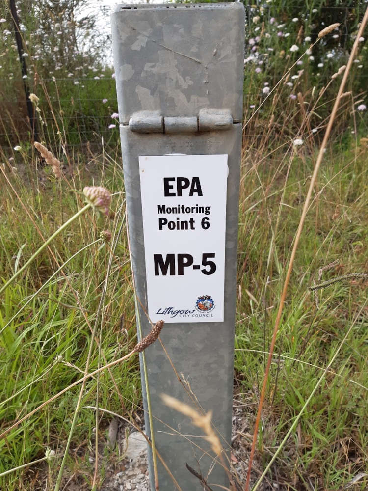
Sample Point 6
Groundwater MP-5
Located adjacent to the site access road on the south-east boundary of the site and approximately 200m from the site entrance. Located just before the site sheds on the left-hand side upon entering the site.
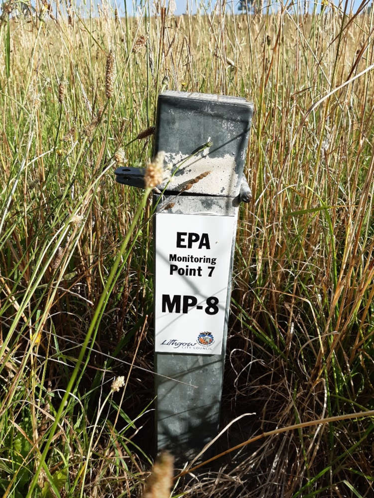
Sample Point 7
Groundwater MP-8
Located to the north of the access laneway running along the northern boundary of the waste depot. The monitoring point is approximately 40m north of the sediment basin dam. This road is external to the site.
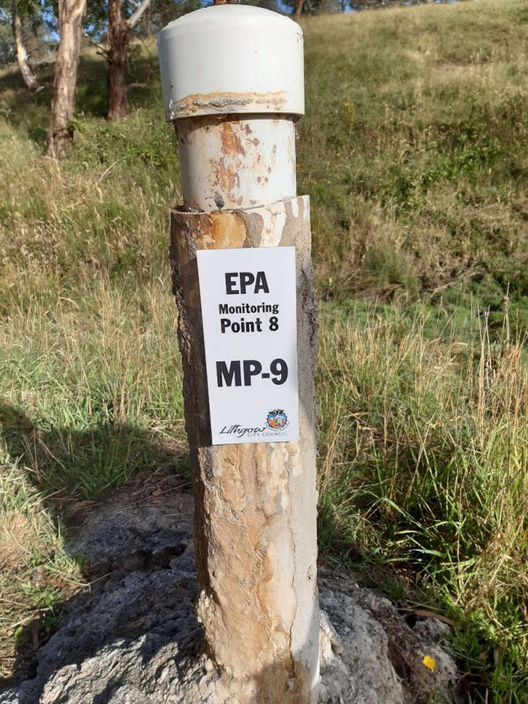
Sample Point 8
Groundwater MP-9
Located approximately 40m from the north-east corner of the site in farmland. Access is from the laneway running along the northern boundary of the waste depot. This road is external to the site.